Warning: dial-up users take note:
many pictures (33).
Decided to take a
good ride through the birthplace of mountain biking: Marin county. Today's ride is known as the "
Marin Headlands Mega Loop." Total distance covered is 18.9 miles (30.24 km). Feel free to click on any of the maps, graphs, or pictures for a larger view.

Being the nerd/geek that I am, first, the maps and distance/elevation graphs. Muahahaha! You know what they say: you gotta quantify your pain! *Evil laughter*
The red dot with "
S" marks the
Marin Headlands Visitor Center and parking lot. It is also the starting and ending point of the ride. Access to the Pacific Ocean is via Rodeo Beach, which is a half-an-hour hike west from the visitor center.
The black dot with "
M" marks the location of Muir Beach, and the half-way point of the ride. Map copyright is owned by
Bike Map Dude Productions. Do not replicate.

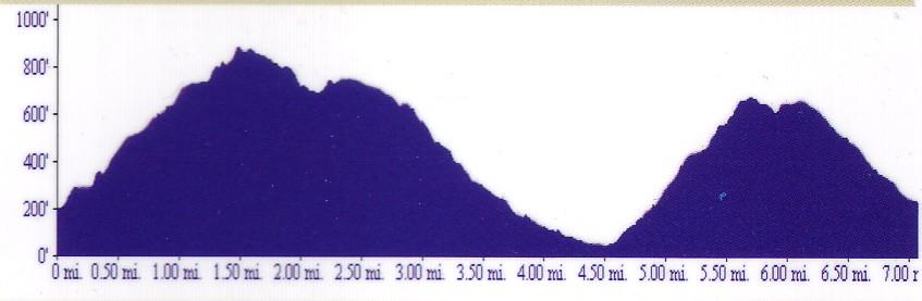
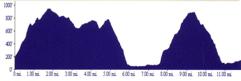
Distance and elevation graph of the first half of the ride.
Distance in miles (1 mile = 1.6 km).
Elevation in feet (3.28 feet = 1 meter).

Distance and elevation graph of the second half of the ride.
(Yes, I like to climb).

A clearer view of the Mega Loop. It kind of looks like a squashed infinity symbol, doesn't it? The center of the loop is the end of Tennessee Valley Road, and the location of
Miwok Livery Stables. Blue portions mark the fire roads, and the red portions mark the singletracks. The first singletrack is a fun downhill and the second singletrack is a punishing uphill. (Map credit: Scott Kendall).
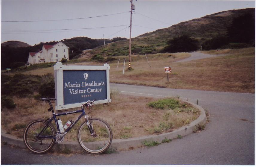
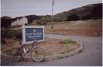 Marin Headlands Visitor Center
 and parking lot. Behind the large white building on the upper left is the
Marin Headlands Hostel, a good place to crash for the night at $18 a head if you are too tired to ride to the San Francisco CalTrain station @ 4th and King (960 feet climb + 12.5 miles away) or drive home.

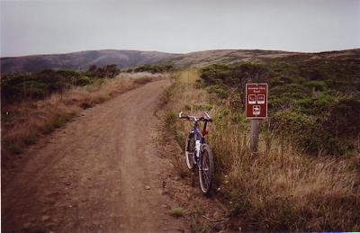
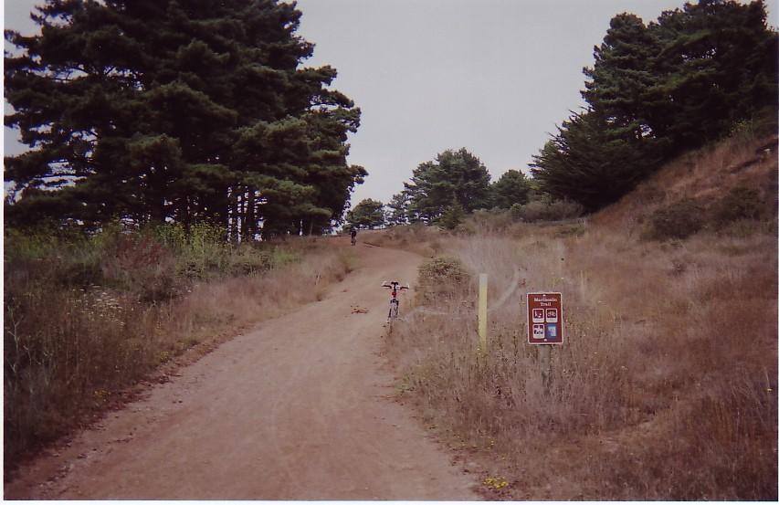
Where the fun begins: Miwok Trailhead. Only 18.9 miles (30.24 km) to go before we return to the same place! Higher res picture
here.

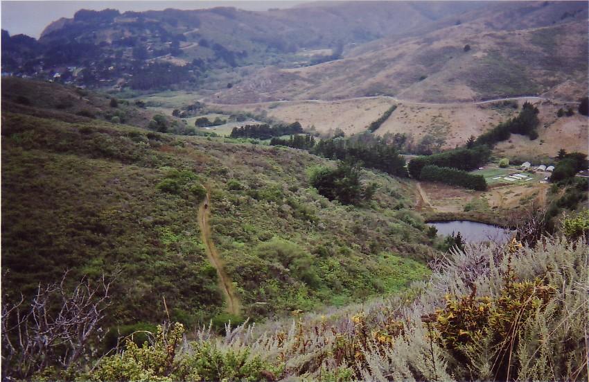
Miwok trail ascending into the mountains (observe the trail carved on the side of the mountain on the upper left). The 40+ year-old lady rider in front, a resident in the area, left me in the dust on the long ascent.
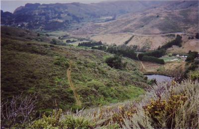
Snaking down the mountain range, from the left to the lower right, is Bobcat Trail, the grin-inspiring return journey to the Miwok Trailhead at the end of the ride.

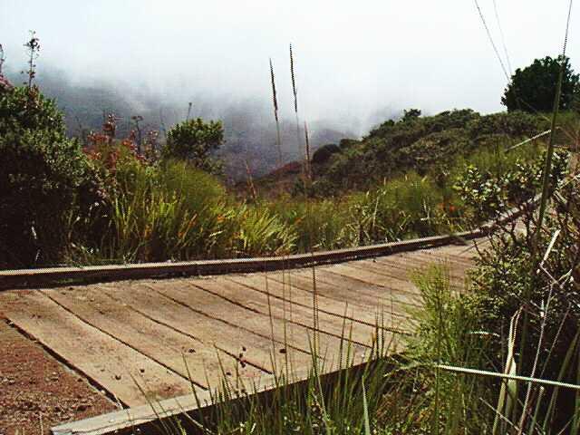
After the steady climb up Miwok Trail, it is time for some sweet payback by taking a left on to Old Springs Trail. Alas my bike didn't stay vertical long enough for me to snap a picture. Seven of these
plank bridges across an equal number of gulches lead to a fast-paced singletrack descent to Tennessee Valley and Miwok Livery Stables. You can spot two other mountain bikers in the center of the picture.
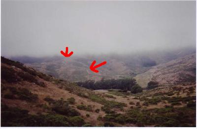
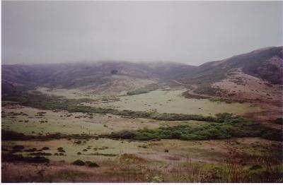
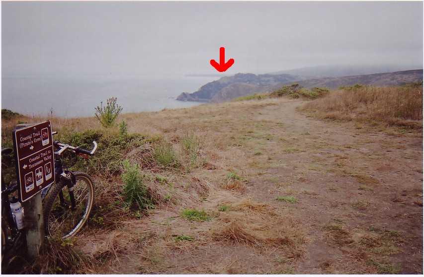
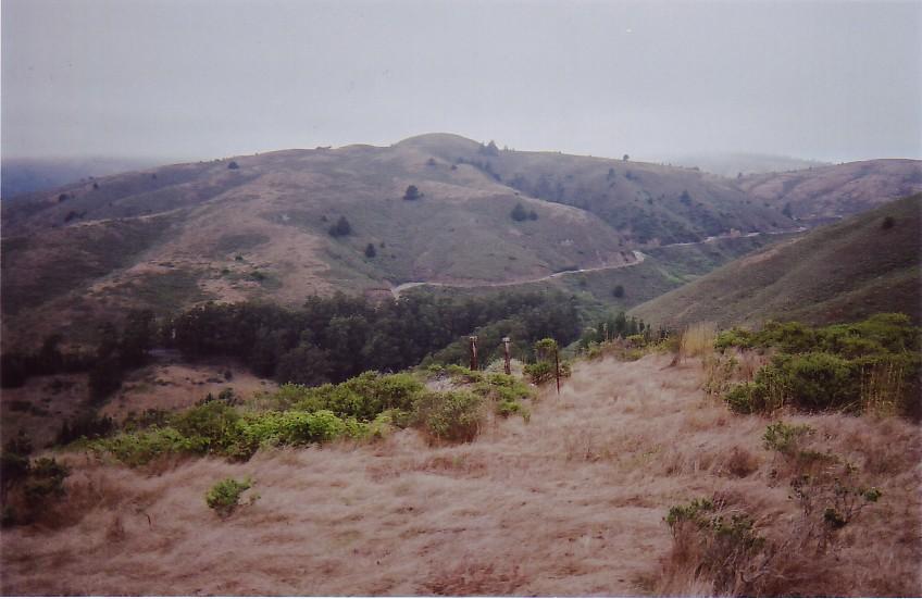
A view from one range to the next. The 2 arrows mark the next trail after Old Springs Trail. The arrow on the right marks the end of Tennessee Valley Trail. The arrow on the left indicates the Coastal Trail. Together, they make for one long grind up to the next mountain range.
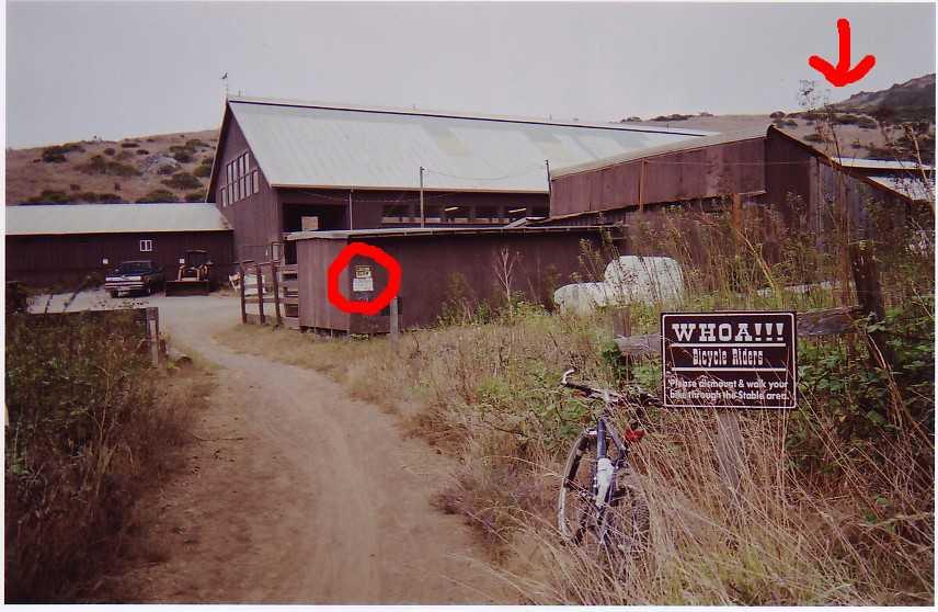
 Miwok Livery Stables
A large sign reminds mountain bikers to slow down: "
WHOA! Bicycle Riders. Please dismount & walk your bike through the Stable area.Further along, there are two more signs (highlighted by the red circle). The yellow one says, "
WATCH YOUR SPEED!" The white sign continues the friendly message, "
THIS IS NOT A @#%!ing FREEWAY!" I guess the stablehands have been spooked one too many times by speeding mountain bikers.
The red arrow on the upper right hand corner highlights the steep and tricky descent portion of Miwok Trail back to the stables. Having good brakes, a helmet, and medical insurance (with a low deductible) will go a long way in inspiring confidence here.
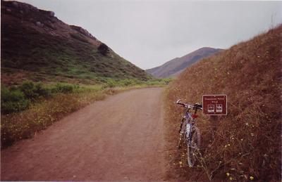
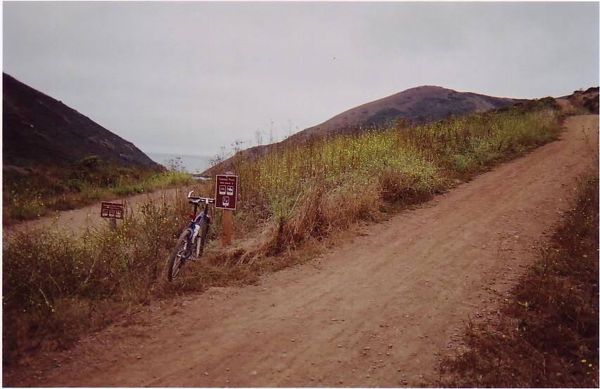
Tennessee Valley Trail.

Still on Tennessee Valley Trail. The trail eventually forks, with a branch off to Coastal Trail, which will reach the peak marked by the red arrow.

Tennessee Trail continues on the left to Tennessee Beach. Coastal Trail forks to the right to the summit of the range.
Took this picture specially for
daftbitch.
Tennessee. Tennessee Valley. Tennessee Valley Trail. Tennessee Beach.
Get it?
ha
ha
ha
*sigh*
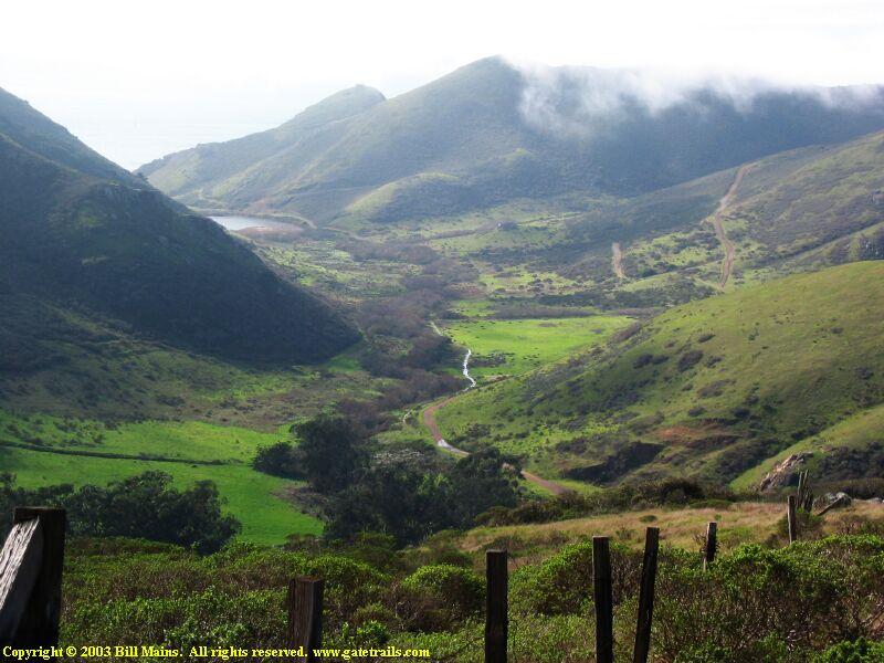
Anyways, here's
a prettier picture of Tennessee Valley by Bill Mains.
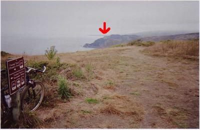
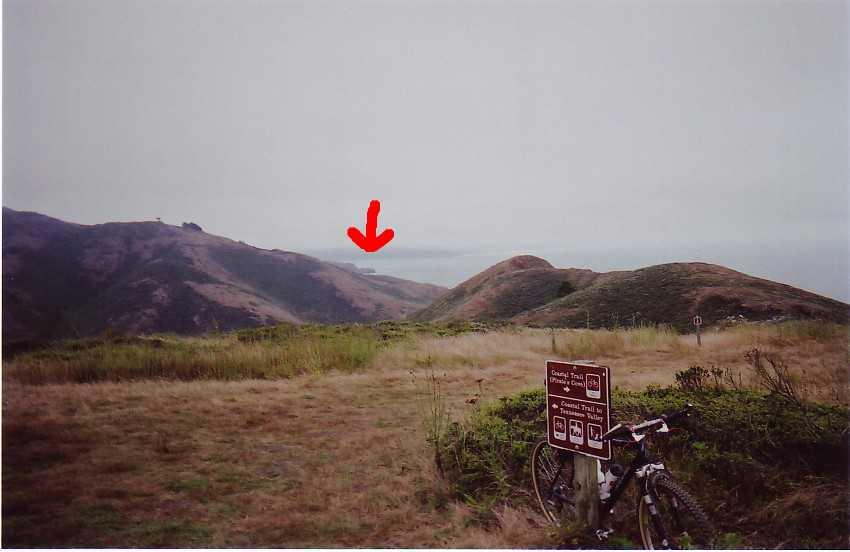
At the summit of Coastal Trail, looking northwards, and a view of the Pacific Ocean. The red arrow marks the location of
Muir Woods Overlook.

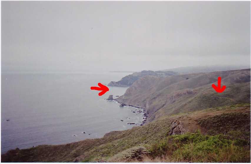
Looking southwards now, the red arrow reveals the location of
Point Bonita. Here's
a nice picture. San Francisco is barely discernible in the distance.

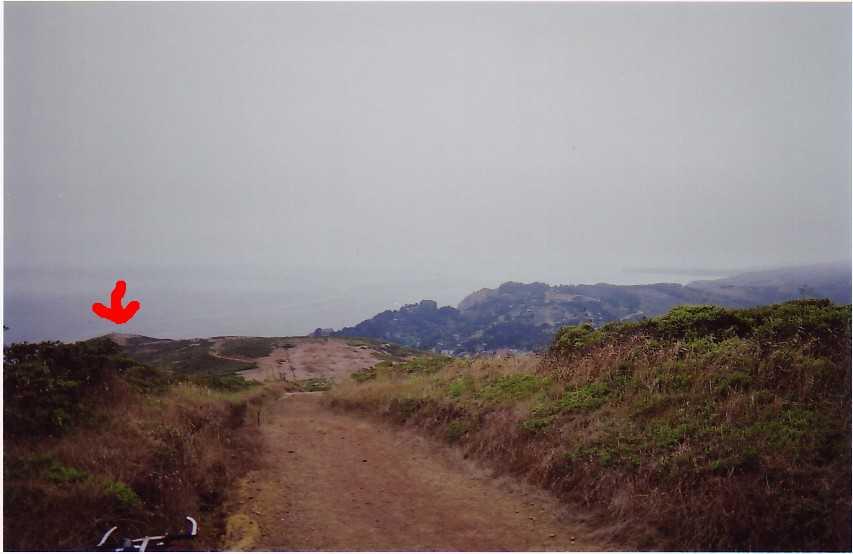
The arrow on the right indicates the "Hikers Only" portion of Coastal Trail. Mountain bikers and equestrians have to take a detour further inland via Coastal Fire Road.
The arrow on the left points to the bay of Muir Beach.
Heading inland (and slightly uphill) on Coastal Fire Road.

5 minutes into the descent of Coastal Fire Road to Muir Beach. The houses of Muir Beach Community are clearly visible. After spot marked by the red arrow, the descent becomes steep and fast. Weekends are not a good time to bomb down this trail as there are numerous hikers and equestrians (running down hikers is bad juju, and trying to run down a horse on your mountain bike is suicide).

The half-way point of the ride: Muir Beach and community.

The return trip now. To get to Middle Gulch Green Trail one has to pass through 2 small farms. There are 2 gates that keep out foraging deer. The honor system is employed: in exchange for access (i.e. to pass through) you agree to close the gate behind you.
Middle Gulch Green Trail is a steep singletrack. Mountain bikers are only allowed to go uphill on this trail, and only in seasons other than winter. The red arrow points to the trail winding its way up the mountain.
Half-way up Middle Gulch Green Trail and looking down. You can see a man on horseback riding down the same trail. Muir Beach Community is still visible, and so is Muir Woods Overlook.
On the right hand side is the farm in the preceding picture (where the climb began).

Took this picture for
crufty.
The road is Shoreline Highway 1, the portion of Highway 1 north of the Golden Gate Bridge. I think an AWD would be awesome to blast up those curves, dude!

Having endured the brutal climb up Middle Gulch Green Trail, I am greeted by Coyote Ridge Trail and a foggy view of Marin City and Tiburon in the distance (left red arrow). Lower down, on the right is
Miwok Livery Stables, my next checkpoint.

A picture taken by someone else on another--clearer--day reveals Marin City, and across the bay to the peninsular, Tiburon.

Getting off Coyote Trail, and on to Miwok Trail for the descent. Observe how the trail literally drops off the picture as it enters the steep section.
Sorry, no pictures of this section as I endo-ed twice (I was too sore).
While descending the steep section of Miwok Trail, I had to remind myself verbally and aloud during the technical portions to "
LOOK WHERE YOU WANT TO GO! AND NOT AT THE GAWDDAMN ROCK / HOLE / RUT / PILE OF GRAVEL THAT YOU WISH TO AVOID!"
Of course, after flying over the handlebar twice, I got the hang of it. As a result, I am quite adept at somersaulting over the handlebars and landing on my back now. *BUMP!* *Boing!* *Aiyee!* *Flip* *SPLAT!* *Groan* *Taa-daa!*

After the steep and tricky descent down Miwok Trail to the stables, and across Tennessee Valley Road, it's time for one more climb: Marincello Trail.

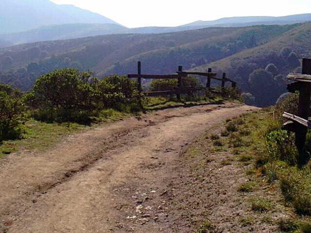
It was 6 PM when I reached the juncture of Bobcat Trail and Marincello Trail. Notice the fog coming in. It's starting to get cold and windy. Luckily, with the exception of 2 short climbs, it is a fast and thrilling fire road descent from here. (With regards to the sign, I am actually headed in the opposite direction. I.e. bike-legal part of the trail).

Descending Bobcat Trail. Red arrow reveals my destination:
Marin Headlands Visitor Center and parking lot. It looks really far away, but at 45 mph (72 km/h) downhill, down wide fire roads with long sweeping turns, I was there in under 4 minutes.
The black arrow points out a "Hikers Only" portion of Coastal Trail descending from Hill 88 (elevation 960 Ft), a vista point across the Golden Gate Bridge. Behind the range is the inlet to the bay, Golden Gate Bridge and the city of San Francisco.

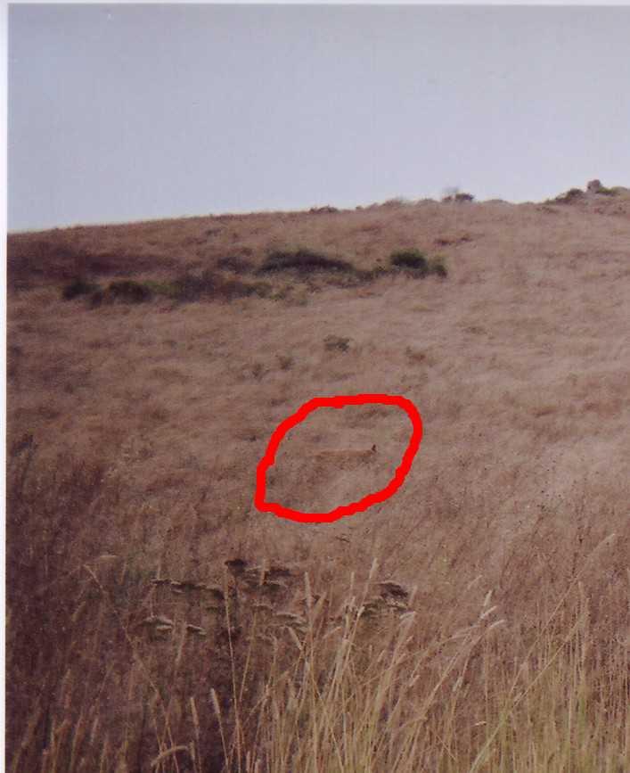
In the final approach to the trailhead, a curious
Gray Fox sitting in the middle of the trail greeted me. He retreated into the grass before I could get my camera on him though.

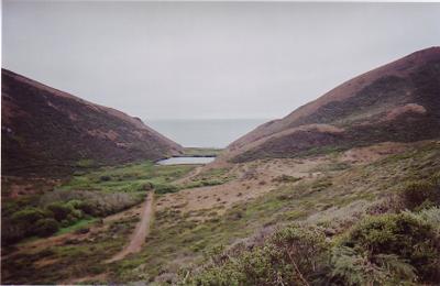
Back at the parking lot of
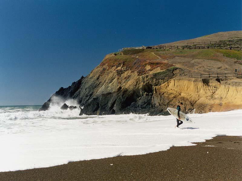
Marin Headlands Visitor Center with my trusty steed, Ivy (with her NOS fork). The body of water is Rodeo Lagoon, which joins the Pacific Ocean one season a year--during the deluge in winter. The strip of sand between the lagoon and the ocean is Rodeo Beach, a popular area for local
surfers. The cluster of buildings is Fort Cronkite. The Lagoon Trail leads to the sandbar between the lagoon and the ocean.
A comforting feature of doing rides in this immediate area is the proximity of
Marin Headlands Hostel (less than a 1/4 mile ~ 300m away). I was tempted to shell out $18 and crash there for the night instead of fighting to stay awake and driving 90 minutes / 60 miles (96 km/h) home.
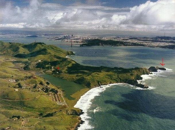
An old picture by Robert Campbell provides some sense of reference: the red arrow on the right points to the location of Point Bonita. Immediately below the red plus sign marks where the
Marin Headlands Visitor Center is. Left of the same sign is the
Marin Headlands Hostel. You can see Rodeo Lagoon and Rodeo Beach. The 3 rows of buildings make up Fort Cronkite. Golden Gate Bridge needs no introduction, and neither does San Francisco. Treasure Island is visible, and beyond is the east bay (Berkeley, Oakland, Union City, etc.)


