Warning: dial-up users beware,
many pictures (60).
Decided not to wait any longer for my GPS software to arrive. I don't know when the owner of
James Associates is going to return from his Labor Day holiday and get round to mailing my CDROM, so here is my trip report minus the elevation/distance charts.
Update: elevation profile added
here.
Prologue:
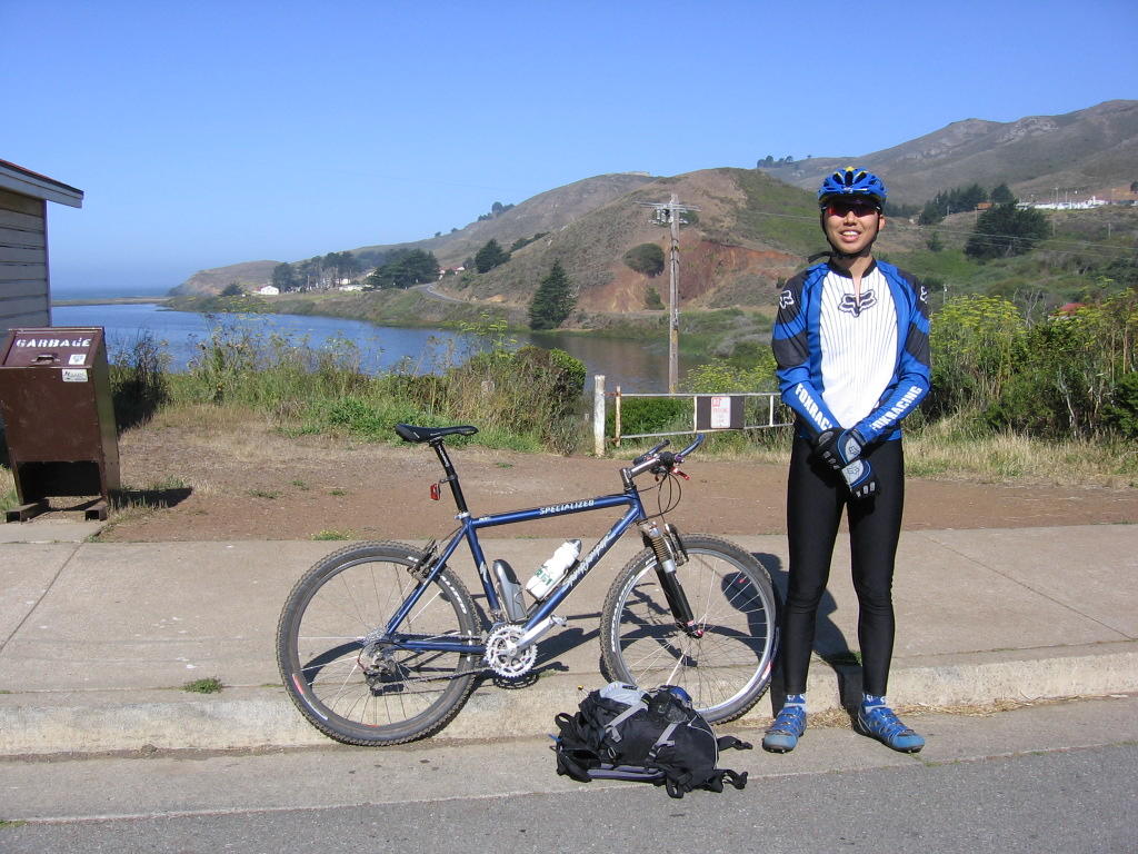
After several non-starts and postponements, I had it and, despite not having slept a wink the night before (
Bad idea. Don't do it), decided to attempt
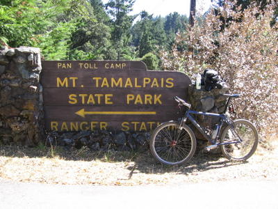
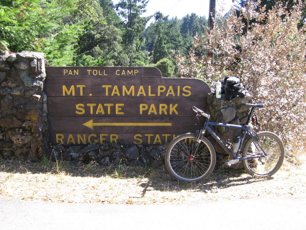
Mount Tamalpais,
off-road and
from San Francisco. And so, I left my apartment at 5:45 AM on Aug 31 2005 with my
pack to catch the 6:01 AM northbound CalTrain to San Francisco.
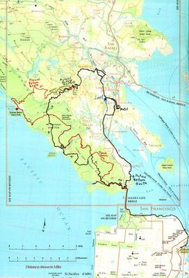
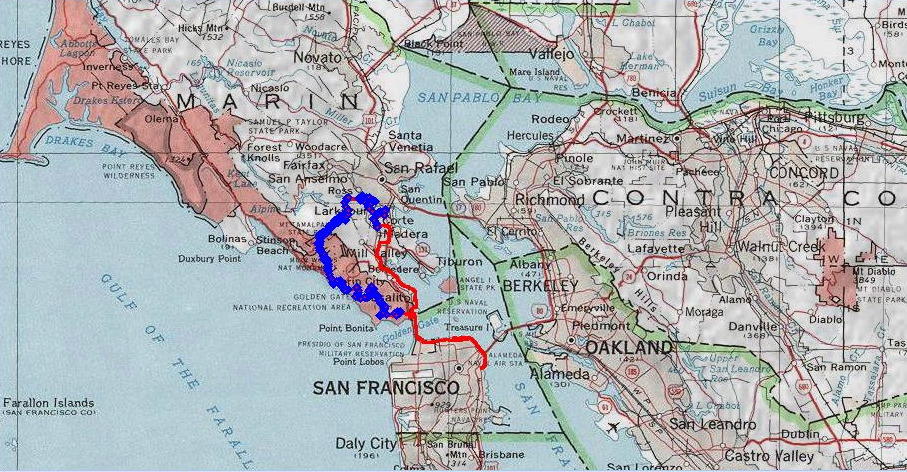
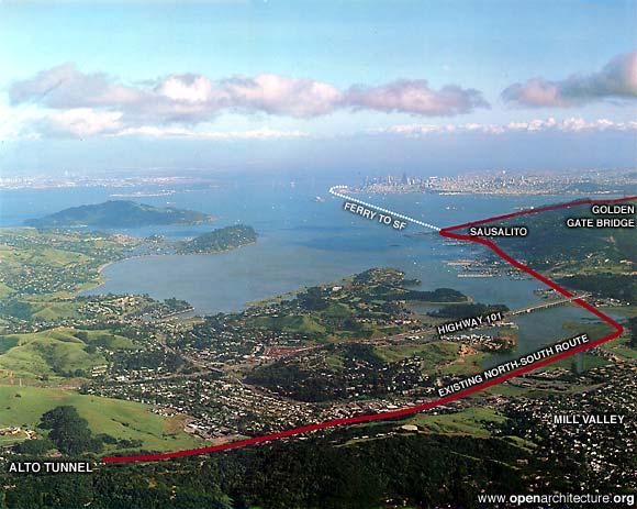
Here is a map. The black line originating from the lower right, from the San Francisco 4th and King CalTrain station marks the to and fro route on the San Francisco side. The red line was the planned (longer) return route, where I will bag
Stinson Beach on the way back.
After the red dot, which marks the summit of Mt. Tamalpais, the black line marks my
actual (shorter) return route.
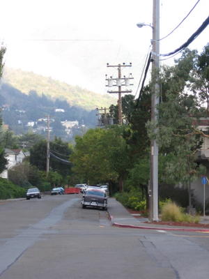
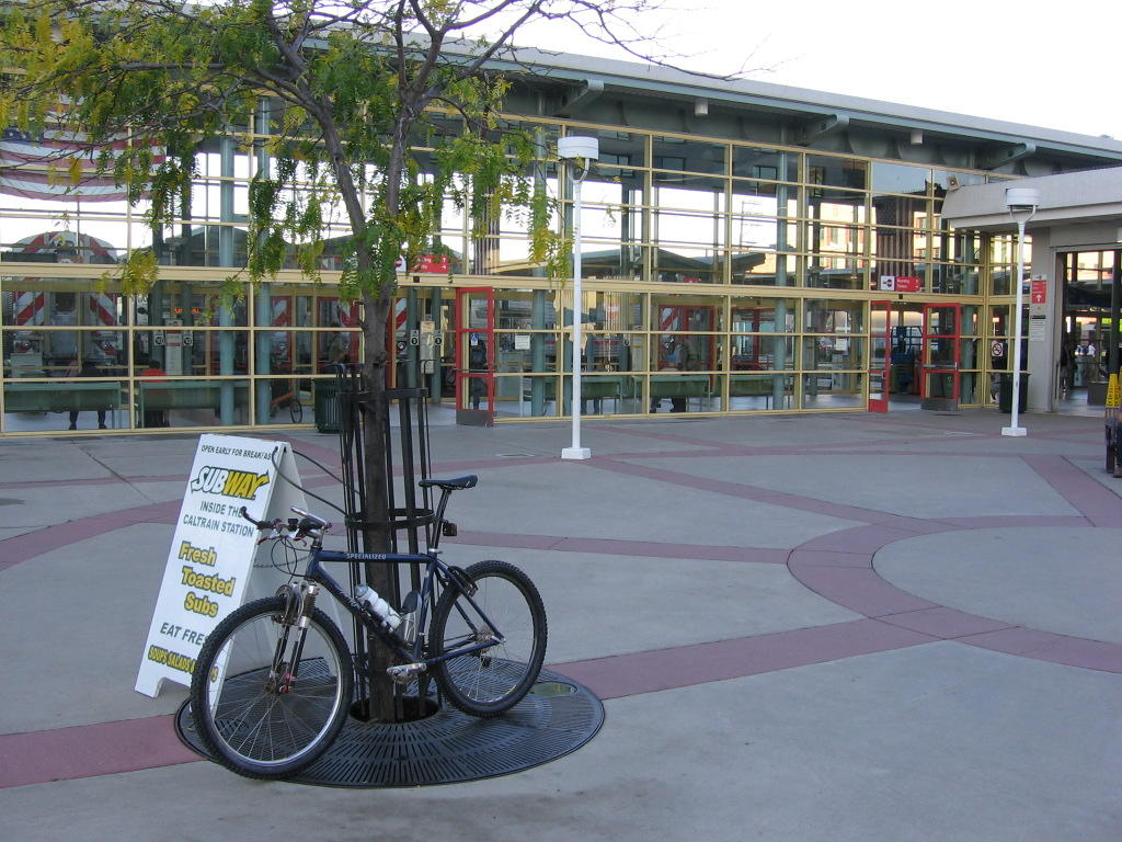
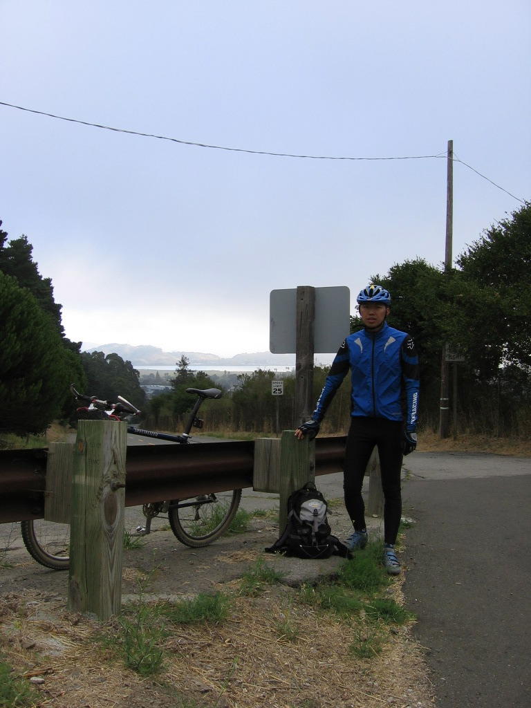
San Francisco 4th and King CalTrain Station 7:45 AM Aug 31, 2005.
Half a mile north of the CalTrain station: it was only here that the
Garmin Forerunner 201 could get a satellite lock.
Tourist trap Pier 39 Fishermen's Wharf at 8:30 AM.
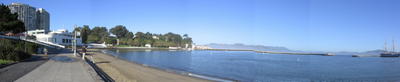
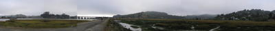
Panorama view: the artificial lagoon on your right is
Aquatic Park, home to several historic sailing ships and the training ground of many cold-water swimmers. Right behind the trees is a 262.4 ft (80m) climb to the top of Fort Mason (which is now an affordable
hostel).
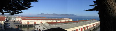
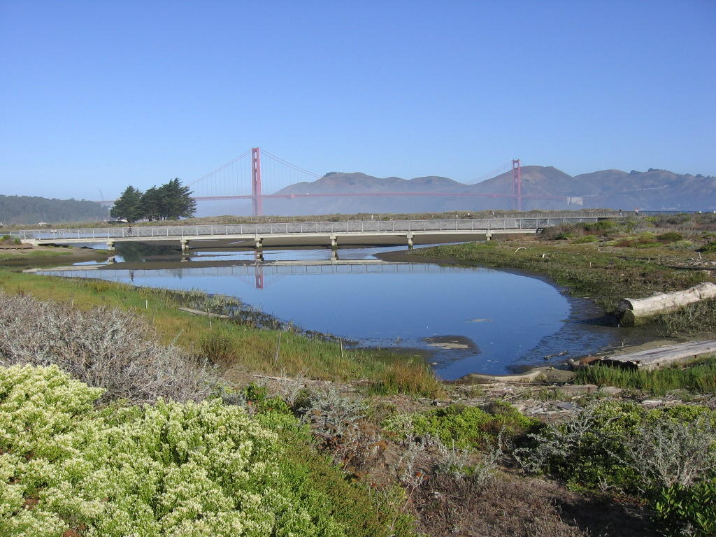
Panorama view from Fort Mason: Golden Gate Bridge, Slacker Hill, Sausalito and Tiburon in the distance.
 Crissy Field
 recreational area. Lots of cute dogs here.
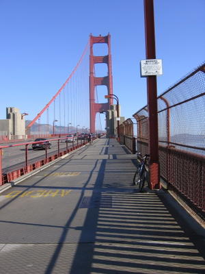
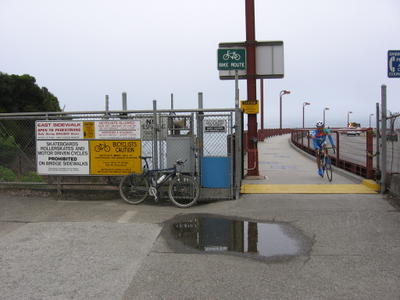
Crossing the Golden Gate Bridge on the east side.
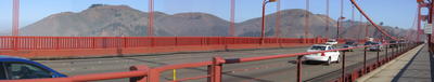
A view of the Marin Headlands from the center of the Golden Gate Bridge. From left to right: Hawk Hill (900 ft), Kirby (900 ft), and Slacker Hill (930 ft). The road leading up is Conzelman Road.
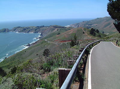
Conzelman Road peaks at Hawk Hill before meandering down to
Point Bonita Lighthouse.

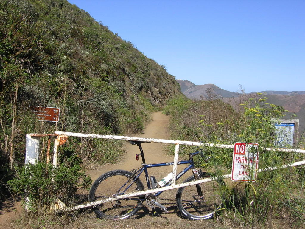
Coastal trailhead. The shrubs and bushes along the trail are not as friendly as they seem: some of them are Poison Oak. The sign state: Rodeo Beach 2.7 miles; Tennessee Valley 7.0 miles; Muir Beach 12.2 miles. The yellow flowers on the right are those of the Dill weed (tastes really good in scrambled eggs).
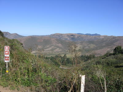
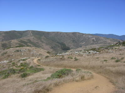
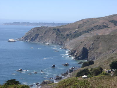
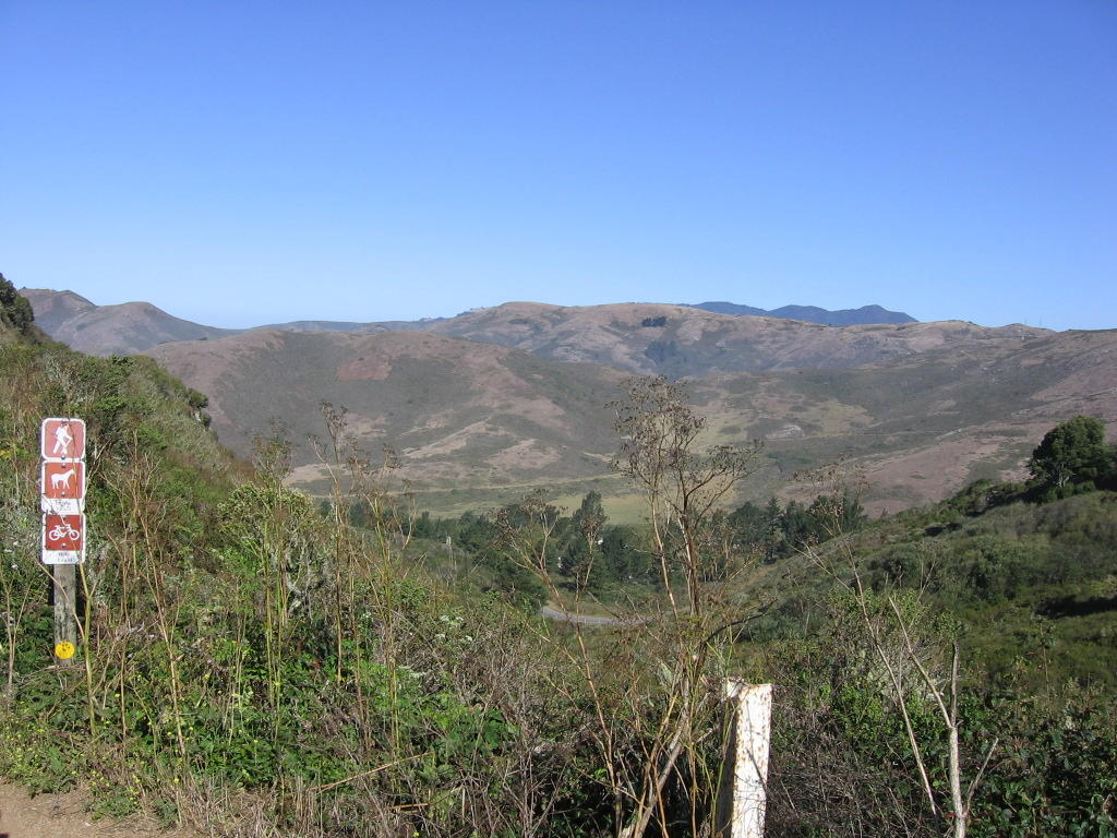
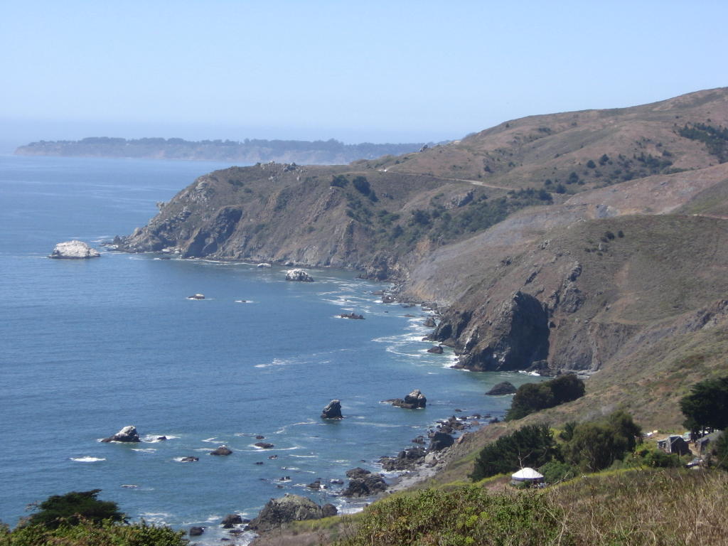
A view of Rodeo Valley from the Coastal Trailhead. Mt Tamalpais can be observed in the distance.

Descending Coastal Trail was a blast (no rangers with radar guns and $135 speeding tickets for going over 15 mph on weekdays. Woohoo!). Taking a breather at the
Marin Headlands Visitor Center parking lot. Rodeo Trail, lagoon, beach and
Fort Cronkhite behind me.
Rodeo Beach has the prettiest multi-colored sand particles, in different sizes. Someday I will drive up there with a glass bottle or two and fill them up as keepsakes.
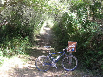
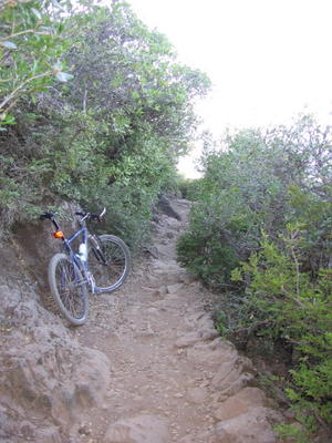
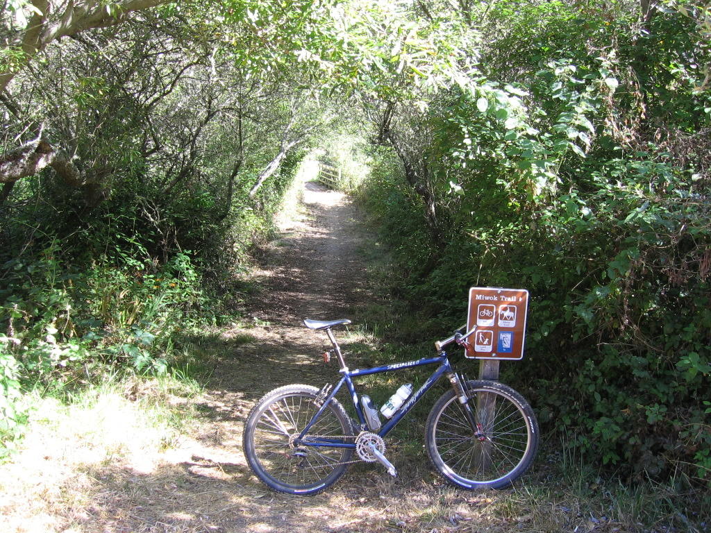
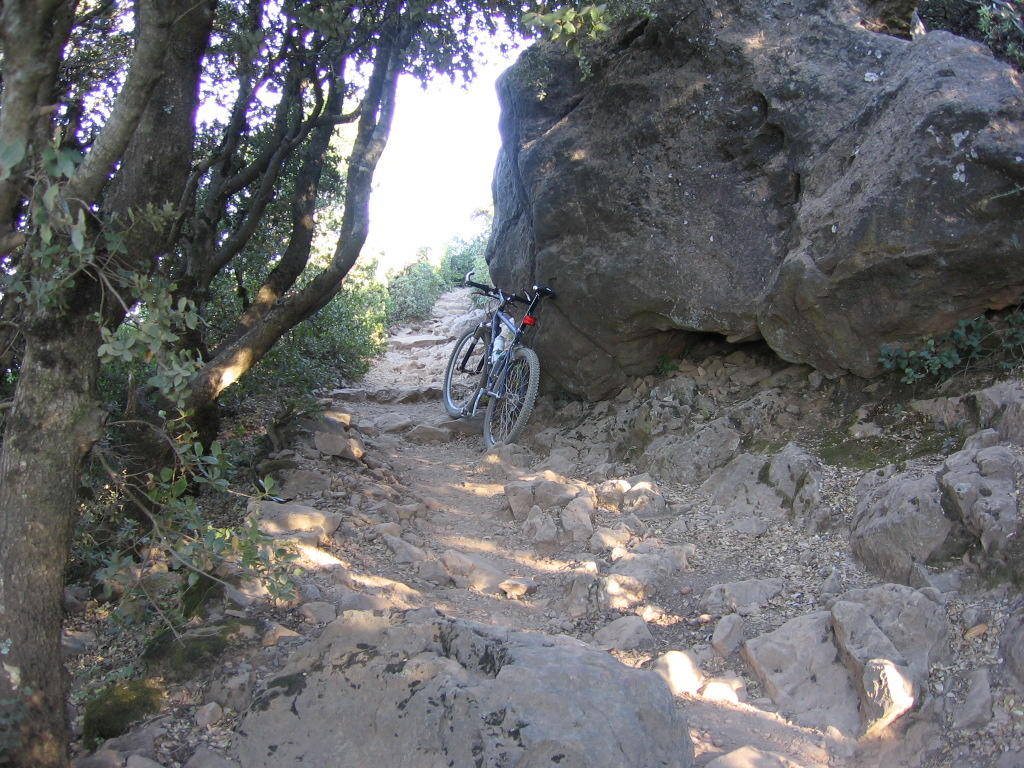
This picture needs no introduction: Miwok trailhead (elevation 30 ft). The foliage may look romantic, but they mainly consist of Poison Oak. Personally, I prefer the
previous picture.
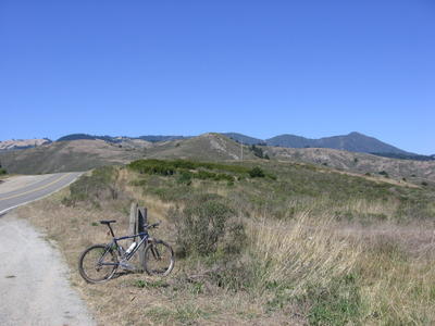
Miwok trail (elevation 600 ft): a view of
Tennessee Valley (elevation 200 ft), and Coastal trail, which climbs to 900 ft.
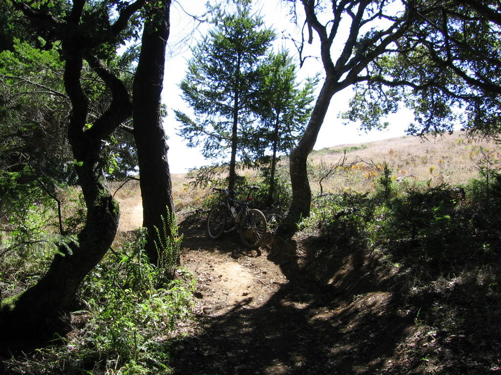
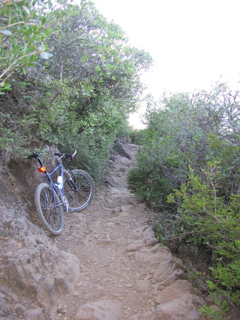
Old Springs trail: sweet singletrack that bombs down to the Miwok Livery Stables. The trail on the left is the return portion of Miwok trail from Muir Beach.
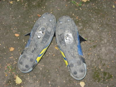
I became overconfident due to my
new tires' phenomenal cornering grip and forgot that, while I can corner faster, I haven't learned to read my line that fast yet. My front wheel went into a deep rut after a corner. The result? A spectacular crash and "endo" at speed. A friendly bush caught me though. Whew! My left pedal released my foot, but not my right. One bolt ripped out and the cleat position was displaced.
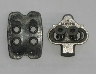
As I did not think to bring spares (who would think to bring spare cleat sets???), I thought the ride was over. Then, upon examining the assembly, I realized that Shimano engineers are geniuses. There are
four bolt holes in the mounting plate. The cleat only need
two to function. I.e. the other two are redundant. Praying that it was the mounting plate's threads that stripped and not the bolt's, I rotated the mounting plate top to bottom, and Voila! I'm back in business.
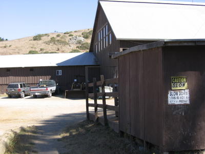
Ripeness is all: the aroma of horseshit in
Miwok Livery Stables greets me.
Breathe, my friend! Breathe! *Choke!* *Gasp!* *Retch!* I know I've taken a picture of this before but I love this sign.
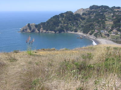
Halfway through Coyote Ridge trail downhill: taking a break to let my brakes/rims cool (you don't have to do this with disc brakes). A view of Muir Beach, Muir Beach Overlook (elevation 500 ft) and Muir Beach Community.
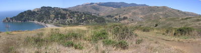
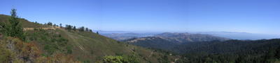
A panoramic view. East Peak of Mt. Tamalpais on the right.
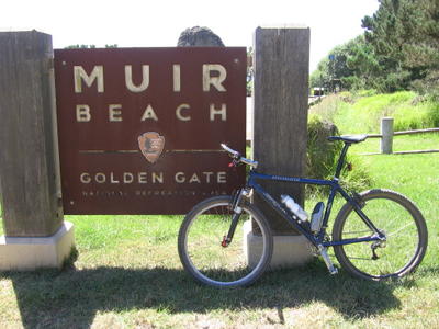 Muir Beach
. Had a lunch of an energy bar here. It's pretty ridiculous that Muir Beach lacks a water source / water access point for the public. The silver container with a black flip-top in the other bottle cage is a
Cage Rocket, which contains my
Gu Energy Gel, energy bars, Espresso Shot candy and rehydration salt mixes.
After 500 feet of climbing along Shoreline Highway 1:
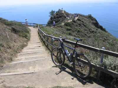
Muir Beach Overlook. The first time I visited this place on a bicycle.
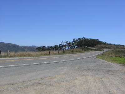
2/3 of a mile north of Muir Beach Overlook is the Coastal trailhead.
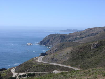
View of Shoreline Highway 1 snaking northwards towards
Stinson Beach.
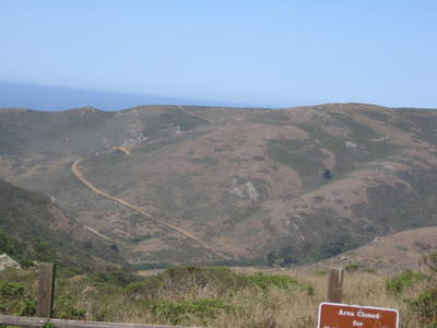
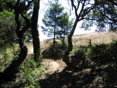
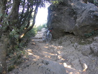
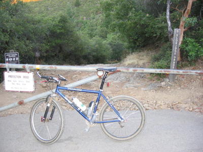
The trailhead is easy to miss from the road if you are driving. On the right is my destination: the East Peak of Mount Tamalpais.
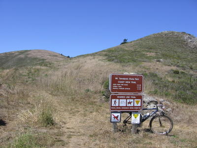
Two trailheads? Hmm...
Shoreline Highway 1 and the Pacific Ocean below me as I climb up Coastal trail.
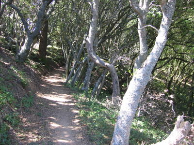
Coastal trail has a multi-faceted personality: it begins as an unshaded singletrack meandering up the mountain, then it slips into shady groves like these...
Only to wind its way out...
And turn into a fire road. A view southwards.
1000 ft of climbing later:
Pantoll Ranger Station (elevation 1500 ft).
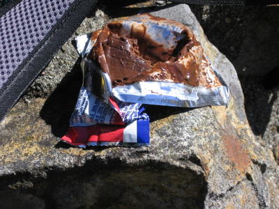
Second lunch break: another energy bar. Yeah, it comes out looking like this as well (and probably tastes the same too!). Highlight: as I was munching, I lost count of the number of thumbs up, "V" signs, and honks, made to me by passengers and drivers as they whizzed by on Panoramic Highway.
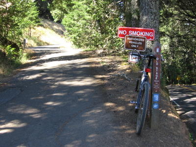
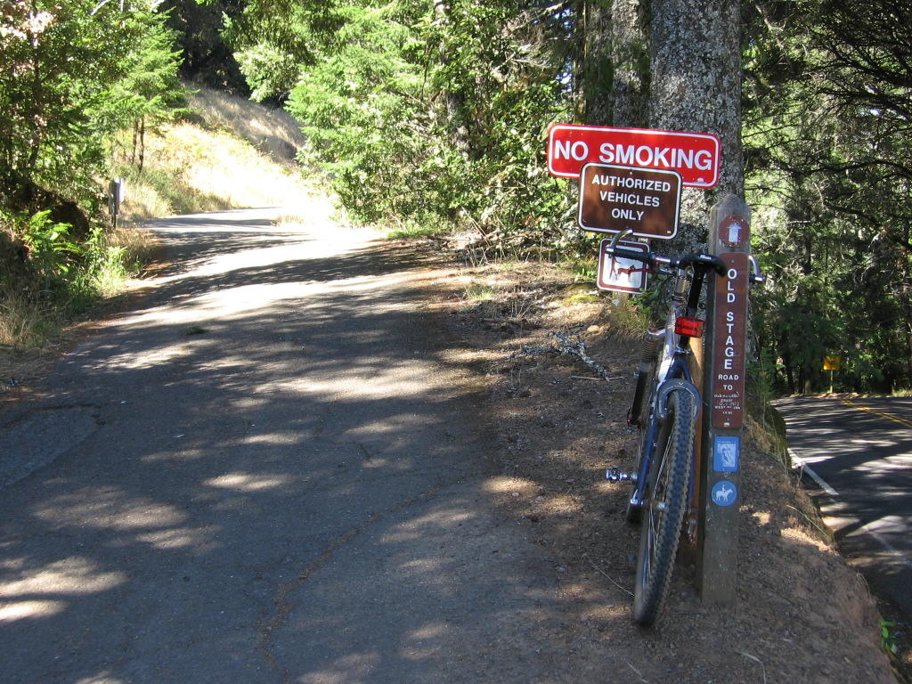
Onward to the summit: Old Stage Road.
Fresh air and a gentle incline with dappled sunshine = heaven on wheels.
Climbing upwards towards West Point Inn (the patch devoid of vegetation on the left). Also, a view eastwards of Mill Valley, Strawberry (the first peninsular) and Tiburon (the second peninsular).

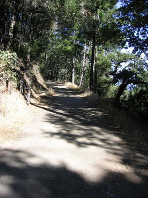
Old Stage Road hugging the side of the mountain.
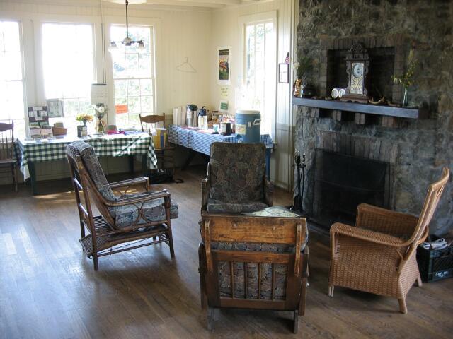
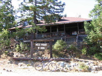 West Point Inn
 (elevation 1780 ft). A possible place to crash in if one can't get off the mountain before dark. Rustic accommodations at $30 a night with a tiny shared 5' x 5' bathroom out in the back. No electricity though. Not sure if they have hot water either. Better than being mountain lion bait out there in the night, I guess. Note: no sheets or blanket provided. Brrrr!

Just found out from a website that West Point Inn sells bottled water, lemonade, energy bars, and other goodies, all for a very reasonable $1 a piece. A couple glasses of cool lemonade would have been heaven. I should have gone inside (like the guy who took this picture).
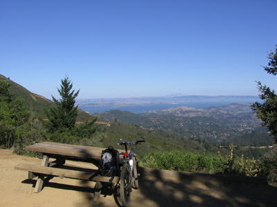
Taking a break and contemplating
Mount Diablo across the bay.
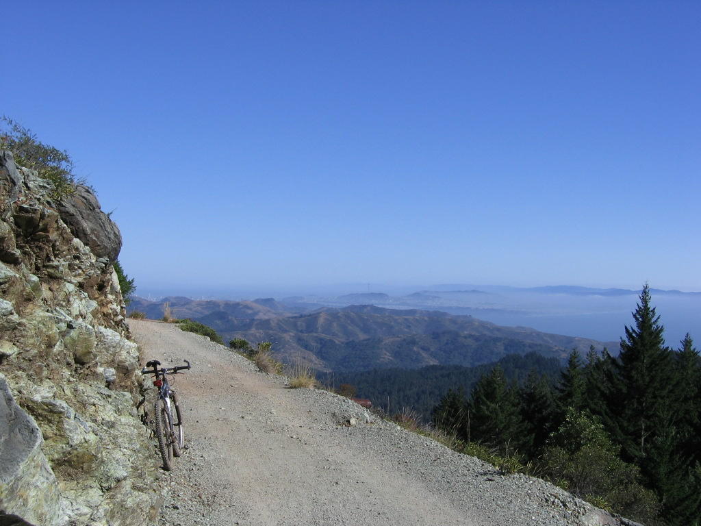
A view of the East Peak of Mt Tamalpais from Old Railroad Grade.
Onwards to the top...
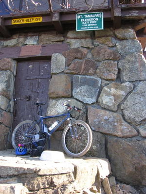
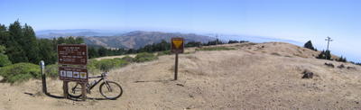
East Peak Gardner Lookout of Mount Tamalpais (elevation 2571 ft / 784 m). The structure is used by the Fire Service to spot wildfires.
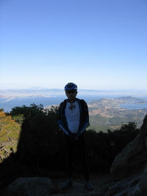
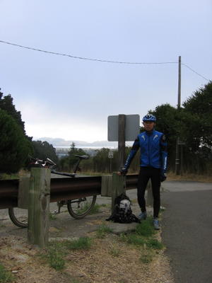
Moi. No, I'm not taking a whiz.
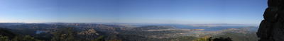
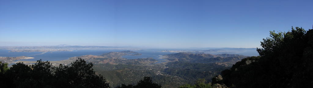
Summit panorama: from left to right, Lake Lagunitas, Richmond-San Rafael Bridge, Mt. Diablo.

What was hidden by the wall on the right: Strawberry, Tiburon, Angel Island, Richardson Bay Bridge, Sausalito, Marin Headlands, Golden Gate Bridge, San Francisco.
The descent.
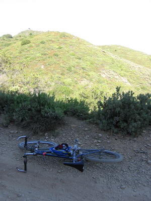
7:25 PM: spent too much time resting on a bench, eating and hydrating, and now I have less than 20 minutes of daylight left to get off the mountain. Ordinarily, I would not have chosen this trail, as it is rated "difficult" and described as "rocky," but a passing rider said it was "not that bad." Well, I forgot that he was riding a full-suspension mountain bike.
Boy, did I find out just how difficult: the upper section of the trail is littered with loose rocks the size of apples, grapefruits and melons. Hardtails have a difficult time dealing with these, especially
at speed. Had a nasty crash here. No friendly bush to save me this time. Landed on rocks. Huge bruise on right thigh (6 inches across), bashed my right knee, and bent the rear derailleur hanger (either that or I bent the XTR rear derailleur). I sure hope
Specialized still stocks spare parts for my bike, or else it's time to hunt for another frame. Later, back at home, I found a write up on Eldridge Grade with the warning that "riding down Eldridge Grade will remove any loose fillings." Well, it certainly earned a testimonial from me.

Before Eldridge Grade swings north, it branches southwards into a monstrous roller-coaster trail called Indian Fire Road. That was the next trail I had to take. With peaks as high as 60 feet and dips just as deep, these huge jumps must be exhilarating during the day, absolutely terrifying in the dark. Got out of the forest at 8:14 PM onto Crown Road, Kent Woodlands.
It was rather difficult trying to find the bike path corridor at night, all the more so when I have never seen it during the day. I cycled around the cities of Kentfield, Greenbrae, Lakespur and Corte Madera for 2 hours looking for the bike path, occasionally locating sections of it, riding them for 10 to 15 minutes, before being inevitably lost again. It was incredibly frustrating. I was also getting tired, hungry, and cold.
The final hurdle involved locating a section of the bike path which leads to a tunnel under Alto Hill. I cycled around the city for an hour, never realizing that it was 50 feet away, right across the street. My tired mind assumed that the structure was just another sheltered bench for park users. When I finally realized my error at 11 PM, I was too tired to continue. I also realized the futility of rushing back to San Francisco to catch the last southbound CalTrain (12:01 AM) as the Golden Gate Bridge is closed to pedestrian and cyclists after 9 PM.
Postscript: I later found out that the map I bought is erroneous (one of its many). The Corte Madera - Alto Tunnel is not open to passage yet. Note: found out that cyclists can cross the Golden Gate Bridge at all hours on the East side. Stand before the gate (where the security camera can see you) and press the red button. A buzzer will sound and the gate will slide open. Repeat on the other end of the bridge.
12:30 AM Sept 1: heated motel room, hot shower, and a $12 artery-clogging sourdough burger on the table. I think I earned it. All I had to eat were the entire day were 5
Gu Energy Gel packets (100 calories each) and 3 energy bars (220 calories each). In any case, I only slept 90 minutes due to exhaustion, after which I was awaken by the pain from my crash wounds (aspirin didn't help). Still, IMHO, the hot shower alone was worth the price of admission.
While I was futilely trying to get some more sleep, my housemate was driving around Mill Valley the entire night, cruising the streets looking for me. So sorry, dude. Next time I will be sure to call him a second time--to let him know that I am safely holed up somewhere for the night. My bad : (
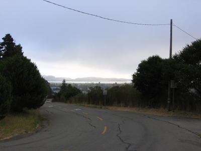
7:30 AM: View from outside the motel, on Meadowsweet Drive. Mount Tamalpais is hidden behind the fog. A little chilly (52 F / 11 C) and windy this morning.
After a series of short climbs up to 200 ft, Meadowsweet Drive loops back north to become Casa Buena Drive. Looking north, the city of
San Rafael and San Pedro Mountain in the distance.
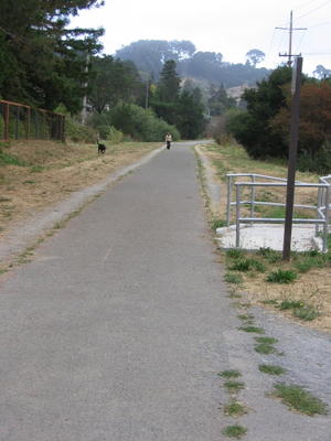
City of Alto: entrance ramp to bike corridor towards Sausalito. It's all road riding today: no need for my visor. Trying not to look too sleep-deprived here.
The bike corridor that is
supposed to emerge from the
other end of the Corte Madera - Alto Tunnel. What I have done then, is to circumvent it, as illustrated in this
picture.
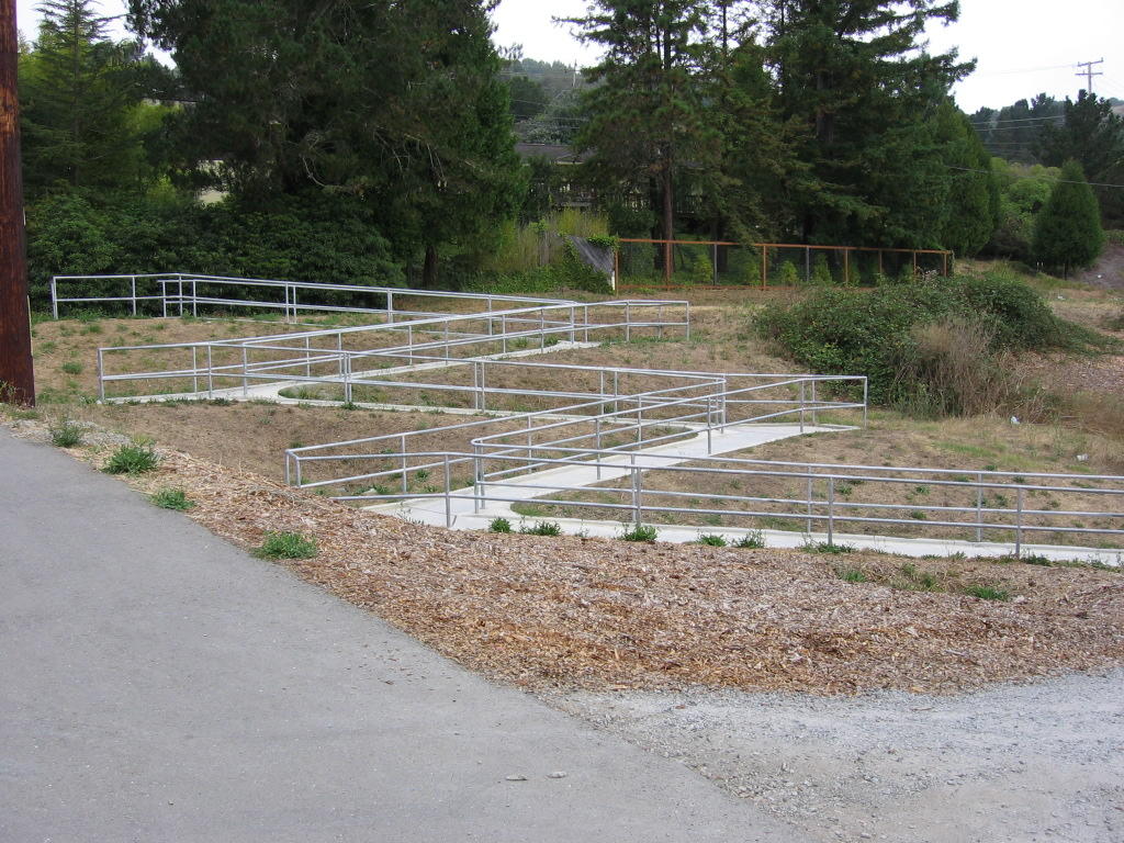
Wheelchair access ramp to the
bike corridor. I wonder what sort of grade (%) they are limited to, or else there is no practical reason why they will build the ramp with this number of switchbacks.
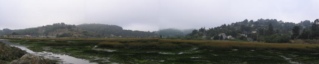
Panorama: left to right, Strawberry, Richardson Bay Bridge, Mill Valley - Sausalito Bike Path (southbound), Marin City, Tamalpais Valley.
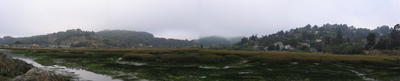
For some reason, the marsh reminded me of the Dead Marshes in Peter Jackson's film adaptation of
The Lord of the Rings. Maybe it is the rich deep hue of green. Or maybe it is because I only slept a total of 1.5 hours in the last 48 hours.
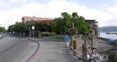
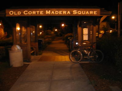
Downtown
Sausalito. A hundred yards down, on the left side of the street, is a hole-in-the-wall place that serves really good burgers. At $14 for a cheeseburger, regular fries and a regular soda (no free refills too!), they sure don't charge hole-in-the-wall prices though.
Crossing the Golden Gate Bridge again. The morning fog hasn't completely burned off yet. Time now is around 10:45 AM.
Reached the San Francisco 4th and King CalTrain Station at 11:22 AM.
Returned to apartment at 1:17 PM Sept 1, 2005.
Epilogue:
Total distance: 65.12 miles / 104.19 km.
Total elevation climbed: 5564.40 ft / 1696.46 m.
Temperature range: 52 F (11 C) to 79 F (26 C)
Amount of fluids consumed: 14 liters.
Self-portraits were taken using
UltraPod II.
This ride was conducted solo.
Stinson Beach for another day's ride then.

 The red line is the entire route. The blue line, overlaying the red, is actually a large number of blue diamonds, each representing a discrete GPS trackpoint. For some reason, the GPS unit had more trouble maintaining a lock on the streets of San Francisco than on the mountains and valleys in Marin.
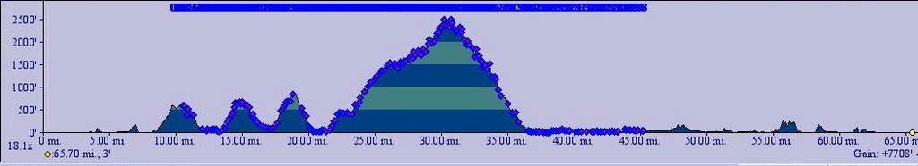 Elevation profile. The blue diamonds each represent a trackpoint left by the GPS device. Somehow, I think TOPO!'s estimation of my total elevation gain for the trip as 7708 feet is grossly exaggerated. My manual calculations yielded 5564 feet.
 This a view of part of Coastal Trail descending from Coyote Ridge (elevation 900 ft) to Muir Beach (sea level). You not only can set the angle of the view, but the altitude as well. The "eye" here is looking straight down from 1437 ft.
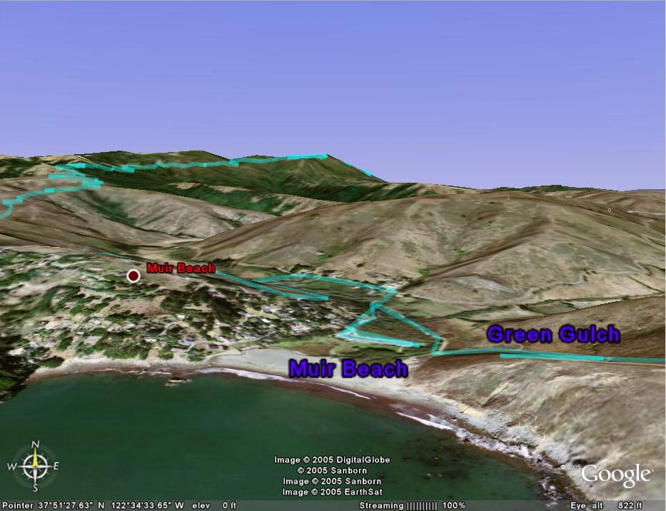 The "eye" is now at a theoretical altitude of 822 ft and looking east. On the right is the descent of Coastal trail to Muir Beach in the center, before climbing 450 feet up Shoreline Highway 1 to take Coastal trail (on the left) 2121 feet upwards to the East Peak of Mount Tamalpais. You can also see a little bit of Eldridge Grade as it winds down the flanks of the mountain.
 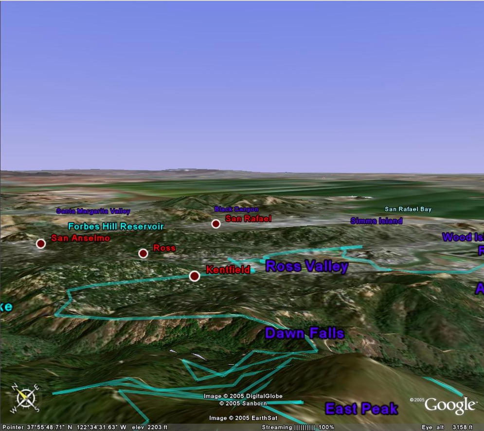 Eldridge Grade's torturous turns as it descends from the East Peak of Mount Tamalpais, as well as the giant rollercoasters of Old Indian trail (section after Dawn Falls).
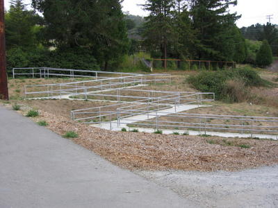
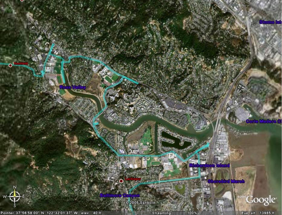 I find this especially humorous. Look at my tracks. Like a mouse in a maze. Yes, I was lost here.
 After 14 hours 9 minutes, the GPS device finally ran out of batteries.
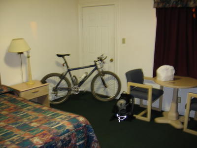
 706 Meadowsweet Drive, where I stayed for the night.
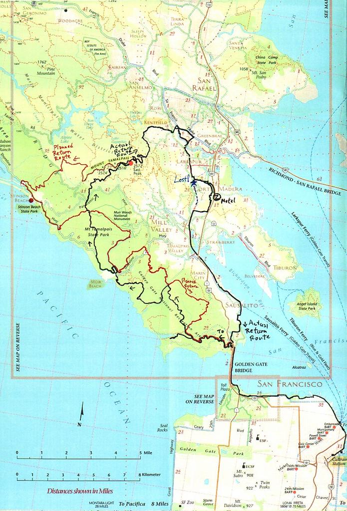


