Point Reyes Lighthouse & beaches
After a number of false starts, I finally managed to return to Point Reyes. It is true then: the place casts a spell on you. I took the easy way out and drove there with my bicycle this time. The experience paled in comparison to cycling. Sure, driving there is a lot easier. But, cocooned within my own bubble, insulated from the elements with climate control, windshield, roof and windows, I lost out on experiencing the sights and smell of the countryside that was granted to me on a bicycle. The car surrounds you. You surround the bicycle. If anything else, I console myself with the knowledge that, while I explored the roads of Point Reyes on slicks on the previous visit, this time I will get to know her trails on knobbies.
 Part of today's itinerary.
 The Great Beach of Point Reyes. Spot the couple on top of the knoll? I am approximately 100 feet above them.
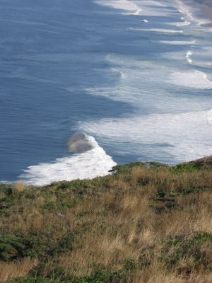 The sun was at the right angle at this hour, and I fortuitously happened to be standing at the right place: the spray created by the crest of the waves become rolling rainbows as they race towards the beach.
 Another rainbow crest.
 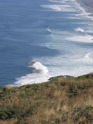 Magical multicolored plumes racing to oblivion...
 This looks familiar: public restrooms. The Lighthouse Visitor Center is behind and perpendicular to the restroom structure. It is also amazingly small, about half the size of the restroom building.
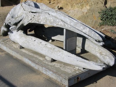 The skull of the whale that escaped my camera on my previous trip.
 Looking down at the Pacific from 500 ft.
 Stairway open. Woohoo! Let's descend 300 feet!
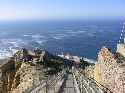 Wider view.
 Point Reyes is the foggiest area known in California and therefore has an uncommonly low light structure. The light was located at the bottom of the cliff near the water, making it visible for seamen navigating through the fog and along the coast in a rough storm.
(Source)
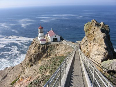 Halfway down.
 Hmm, what does the sign say?
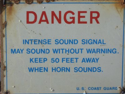 OK, two problems here. One, if the horn may sound without warning, how do you know to keep away when the horn sounds? Unless you can run faster than the speed of sound. Two, that sign is a lot closer than 50 feet to the horns. My ears are still ringing.
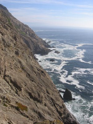 One of the principal reasons why Northern California had little to worry about an amphibious attack. It is like, "Trebuchet this, bitch!"
 Forged iron panels make up the structure of the lighthouse.
 Close up of the lighthouse. Second level deck. The top level houses a 1st order Fresnel lens (i.e. 12 feet tall and 6 feet across!). Trivia: those flat pieces of plastic used as magnifying glasses for books and stuck on the rear of buses and vans are Fresnel lenses.
 On 2nd level deck.
 Time to return to the top. 300 feet ascent.
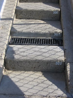 They number the steps, but what they don't tell you is that they put a ramp 3/4 of the way. I.e. it is effectively more than 302 steps.
 Bidding farewell to the lighthouse from the top.
 100+ mph (160 km/h) wind gusts recorded. Woah!
 Decided to climb to the top of the hill. Looking north. Left to right, The Great Beach, Inverness Ridge in the distance, Barries Bay (part of Drakes Estero).
 Lots of Poison Oak around here, but fortunately, I belong to the 15% of the population that's immune to urushiol. I can roll in it, and nothing will happen to me. But if I were to shake your hand, you won't be able to really use that hand for the next 2 weeks (plus, the itching and leaking blisters will keep you awake all night). Same thing happens if you touch anything I touched. E.g. a door knobs, faucet taps. If I were to hug you, you will end up in the hospital receiving antihistamine shots for severe dermatitis. Sometimes it's not so bad to be an oddball, eh?
 Looking south. Container ships having left the Port of Oakland in San Francisco Bay and heading for Japan.
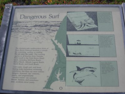 Sign at South Beach.
 South Beach.
 In need of a haircut.
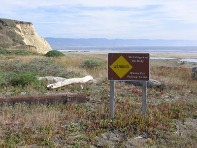 Drakes Beach.
 Chimney Rock on the far left.
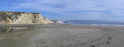 Looking north. Inverness Ridge and Limantour Beach in the distance.
 Lunch. Hey, the luxury is in the sights, sounds, and space.
 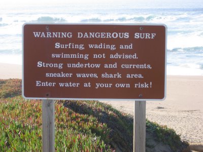 Sign at North Beach.
 Log tossed by a sneaker wave. Visualize that landing on you, together with a wall of water. Ouch.
 Can you spot the people near the water?
 Zooming in... See them now?
 After driving 26 miles from the Lighthouse, this is the sign before the final downhill to the hostel. So my estimation on my previous trip was right on the money. The grade is indeed 17%. Blasting down is pure adrenaline. Climbing up builds character.
Upon reaching the hostel and checking in, one of the staff, Bob, sought my help regarding his Microsoft Internet Explorer. For some reason, the address bar shrunk to the size of a button. Clicking on it does nothing. Unchecking "Address Bar" causes it to disappear. Neither can you click and expand the tool bar. I spent a good 10 minutes on it and read the usual dribble in the help section: e.g. click and drag to adjust size of buttons; pledge your first-born to Bill Gates, etc. I tried many of the suggestions. It didn't work. Then Bob came by and asked me what the "Lock Tool Bar" check mark does. I tried it, and sure enough, it worked. Bob was over enjoyed--he could get back to work. I was befuddled (but not surprised) at Microsoft's clunky interface. It is so counter-intuitive. If Microsoft produced cars, you can be sure you need to hit 20 buttons to navigate through 19 submenus to get your windshield wipers to work.
Anyways, I thought it ironic that, having escape the city to the countryside, here I am fixing someone's computer.
Part of staying at a hostel is the understanding that one should volunteer for a chore (5 - 10 mins) each morning. The next morning, Bob informed me that I already did my chore for the day by fixing his computer for him the night before. That's nice. It means I have more time to cycle or take a slower drive to the trailhead. : )
To be continued...

0 Comments:
Post a Comment
<< Home